Turkey: June 6, Istanbul, Chora Byzantine Church
Today is our first full day in Istanbul. Days begin early on Odyssey tours, we have a lot to do and see today. Tours are not relaxing like a "vacation", we keep moving so we can see a lot. I'm not complaining, just explaining!
So 7 a.m. finds us downstairs looking for the breakfast room. Wow. What a display of food. Sliced fruits and fruit salad. Yogurt with many types of preserves, honeys, and granolas. Buffalo yogurt in jars. Smoked salmon, various sliced salamis, sliced cheeses. Cereal. Dried figs and other fruits. Sliced tomatoes and cucumbers. Olives. Tarts, croissant-like pastries, muffins, and loaves of bread ready to slice. Hot scrambled eggs that taste really good, along with potatoes and sausages. Borek, a traditional Turkish pastry of phyllo dough layered with eggs and cheese. I want to taste everything, I want this every day of my life!
After filling our plates we gather at white linen covered tables, and are offered coffee and orange juice. Conversation drifts back and forth between getting to know each other and the noises we heard from the Taksim Square protests last night. Then, ready for our first day's outing, we walk past the barricades to our awaiting bus. Our destination is Old Istanbul.
First a little geography. Below is a great map of Turkey from turkeytravelplanner.com. Turkey is all the green area on this map. Istanbul in the upper left corner (northwest). Note the waterways that connect the Black Sea to the Mediterranean Sea. First is the narrow Bosphorus, then the Sea of Marmara, then the narrow Dardanelles. Strategically speaking, control of the Bosphorus and Dardanelles means control of trade between the two seas. Also, over the ages people could easily cross the narrow waterways to navigate between Europe and Asia Minor. It's easy to see why a city grew at this location.
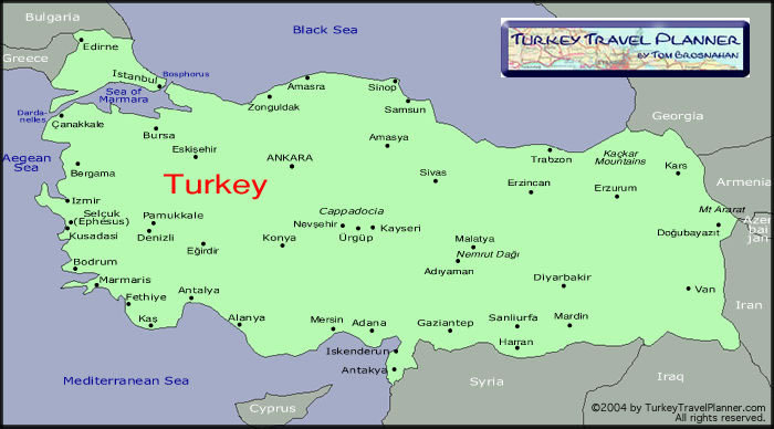
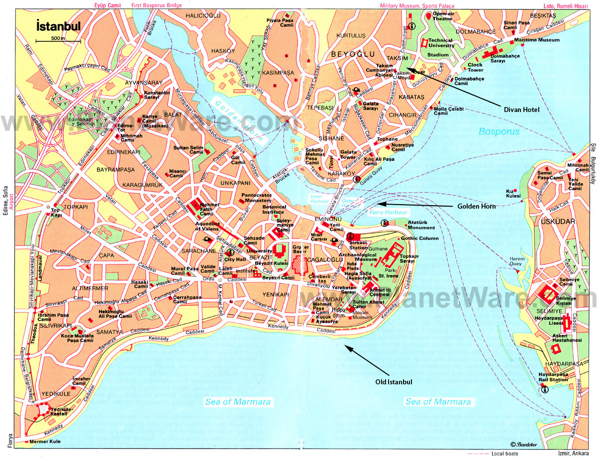
Old Istanbul is located on a peninsula formed by the Bosphorus, the Golden Horn, and the Sea of Marmara. The Golden Horn is an inlet of the Bosphorus, a natural harbor for the Greek, Roman, Byzantine, and Ottoman ships of yore. Today modern Istanbul spans both the Golden Horn and the Bosphorus.
Below is a map of Istanbul, courtesy of planetware.com. The Divan Hotel is on the western shore of the Bosphorus. I added three arrows: one marks our hotel, one marks a waterway called the Golden Horn, and one points to the area of Old Istanbul.
Old Istanbul was once a seaport named Byzantium, settled by Greek colonists. In 322 AD, Constantine the Great, a Roman emperor, decided to establish a new capital in Asia Minor. He chose Byzantium as the location. In 330, the city was renamed Constantinople, and it grew into a center of learning, prosperity, and culture, the center of the Byzantium Empire. It wasn't until 1453 that it was conquered and renamed Istanbul by the Ottoman Turks.
Today, Old Istanbul is rife with ruins of churches, mosques, palaces, and more. Tourist attractions, yes, but so interesting.
Our bus crosses the Golden Horn via the Ataturk Bridge. We see ruins of the walls that once surrounded the old city. I imagine how it must have felt living in the old walled city.
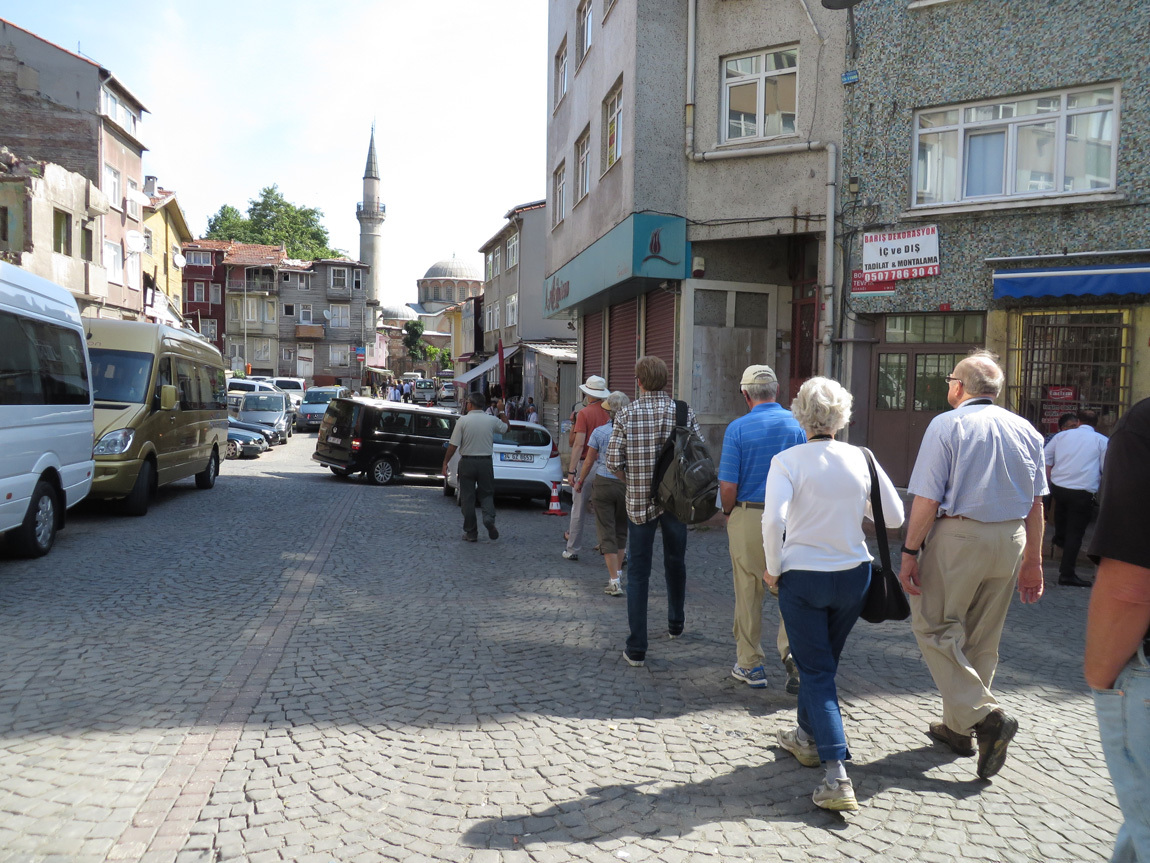
Our first destination is the Kariye Museum or, the Chora Byzantine Church. Our group follows Ali, carrying the umbrella. The umbrella helps us find him in the crowds. He gave us "whisperers", small radio receivers with headphones, so we can hear him talk about the sights. He can talk in a low voice, thus not disturbing the other tourists. Here we are, approaching the church:
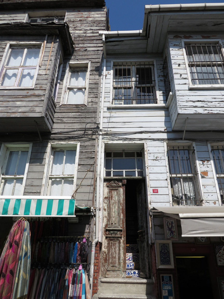
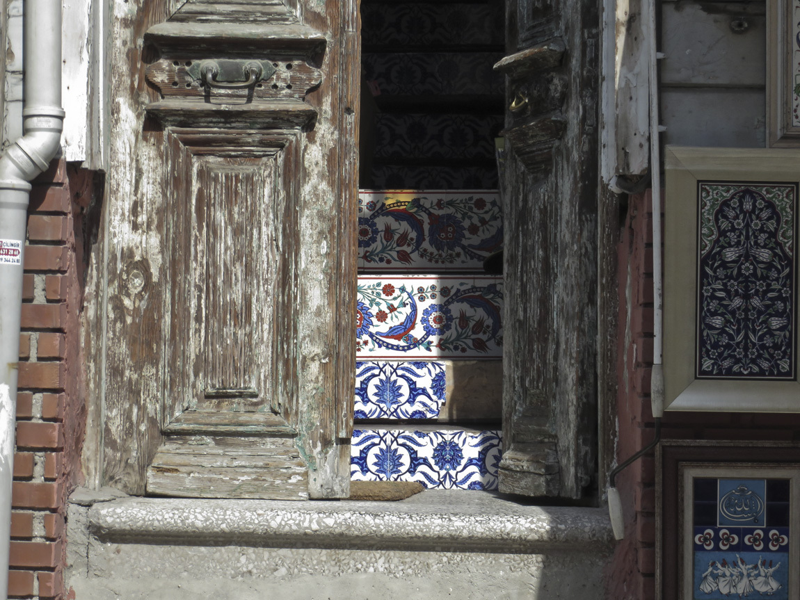
Along our path is a multi-storied wooden building. I was intrigued by the pretty tiles that peaked out of a door of this decrepit building.
Nearer to Chora:
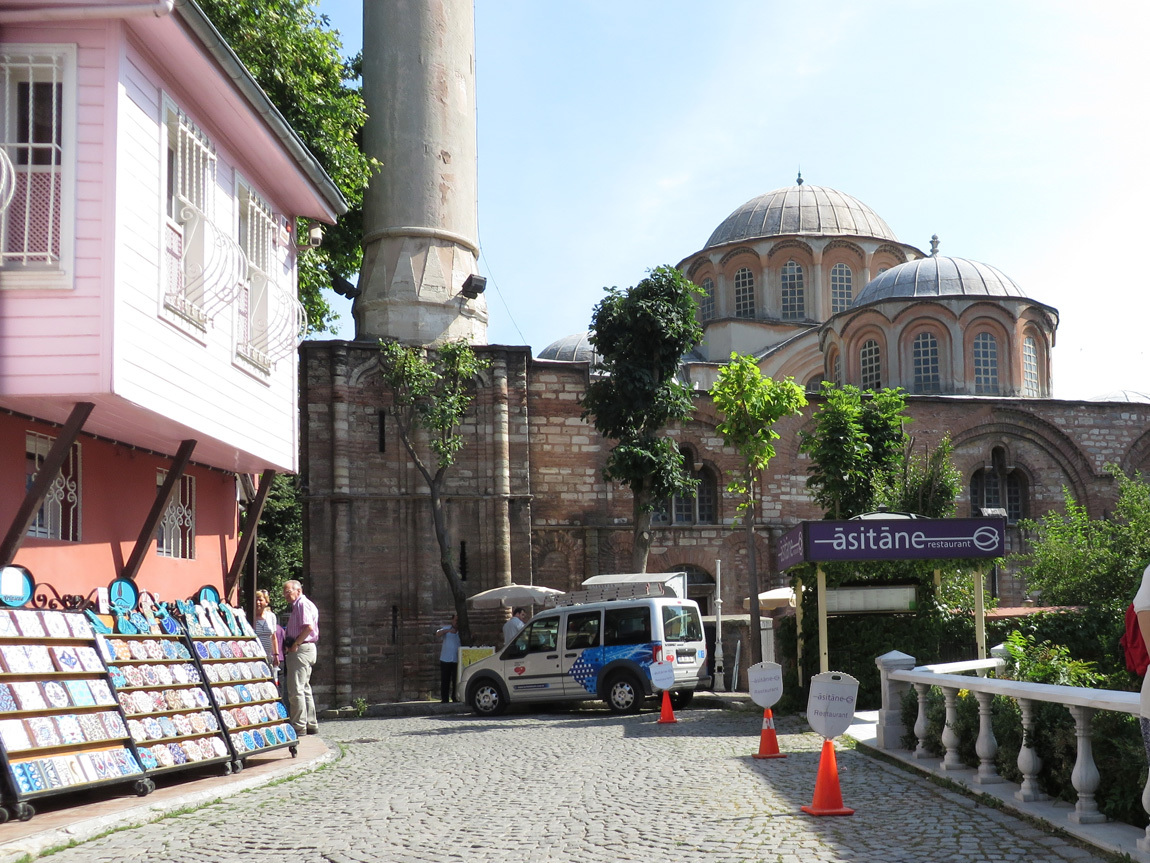
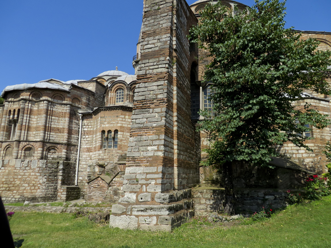
The Chora Byzantine Church was built in the 5th century, then extensively remodeled in the 12th century. It is one of the best surviving examples of a Byzantine church. The interior is covered with mosaics and frescos. The problem is that after Constantinople was conquered by the Turks in 1453, the Chora Church was converted into a mosque. Since Islam prohibits iconic images or any protrayal of human or animal forms, the mosaics and frescoes were covered with plaster. In 1948 it ceased to be a mosque and restoration of the original Byzantine interior began.
Here is another photo of the outside:
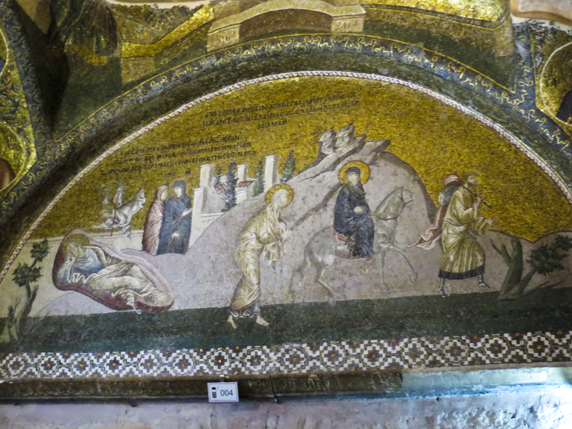
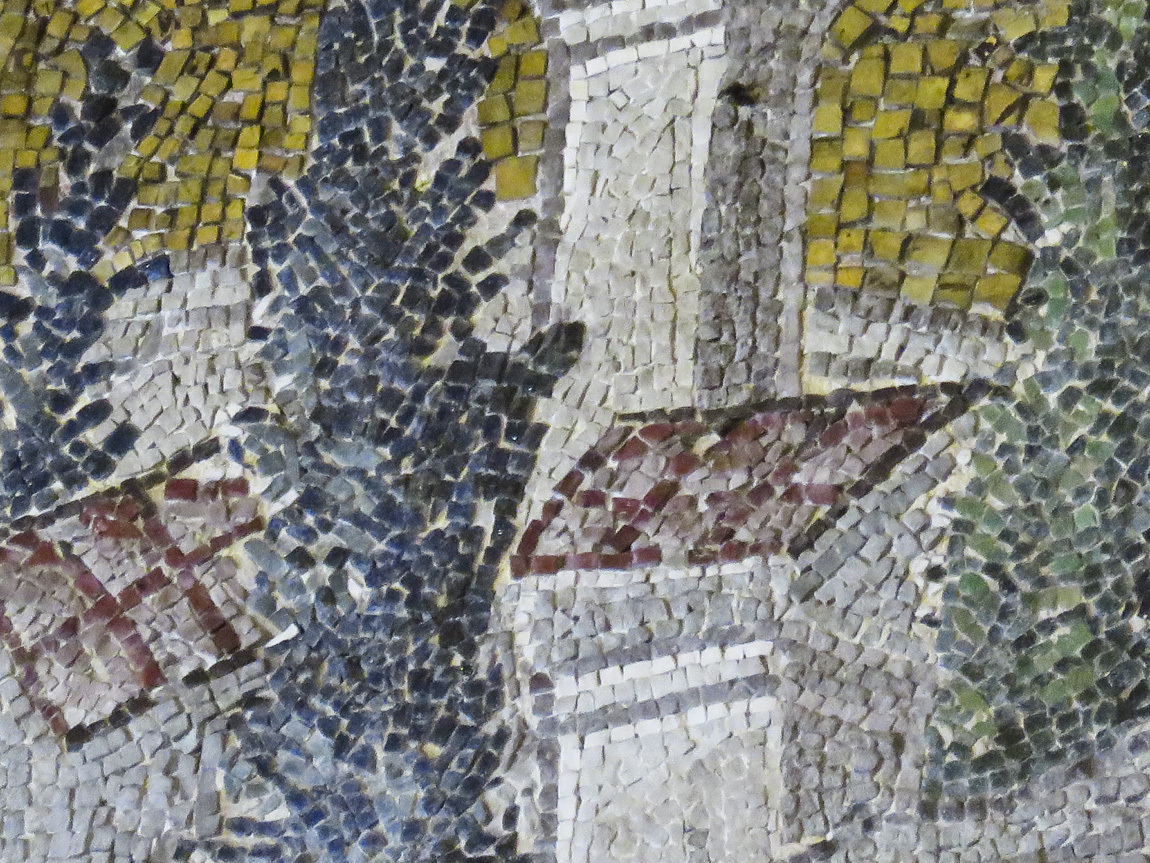
The tiles in the frescoes are smaller than I had expected. I took a few photos, but they are not really very good. It was difficult to get good photos because of the light and because it was very, very crowded! I'll just put a couple examples below, and advise any reader to check out the Wikipedia and museum links for professional photos.
(I didn't take my dSLR to Turkey, relying instead on a small, zoomable, pocketable, new Canon SX280 HS. Composing photos in the display instead of a viewfinder was often difficult, I'll apologize just this once for all of my photos on this trip. At home now, I am finding that I do appreciate the geotags on the photos. Win some, lose some.)
One of the frescoes inside:
A zoom in on the tiles:
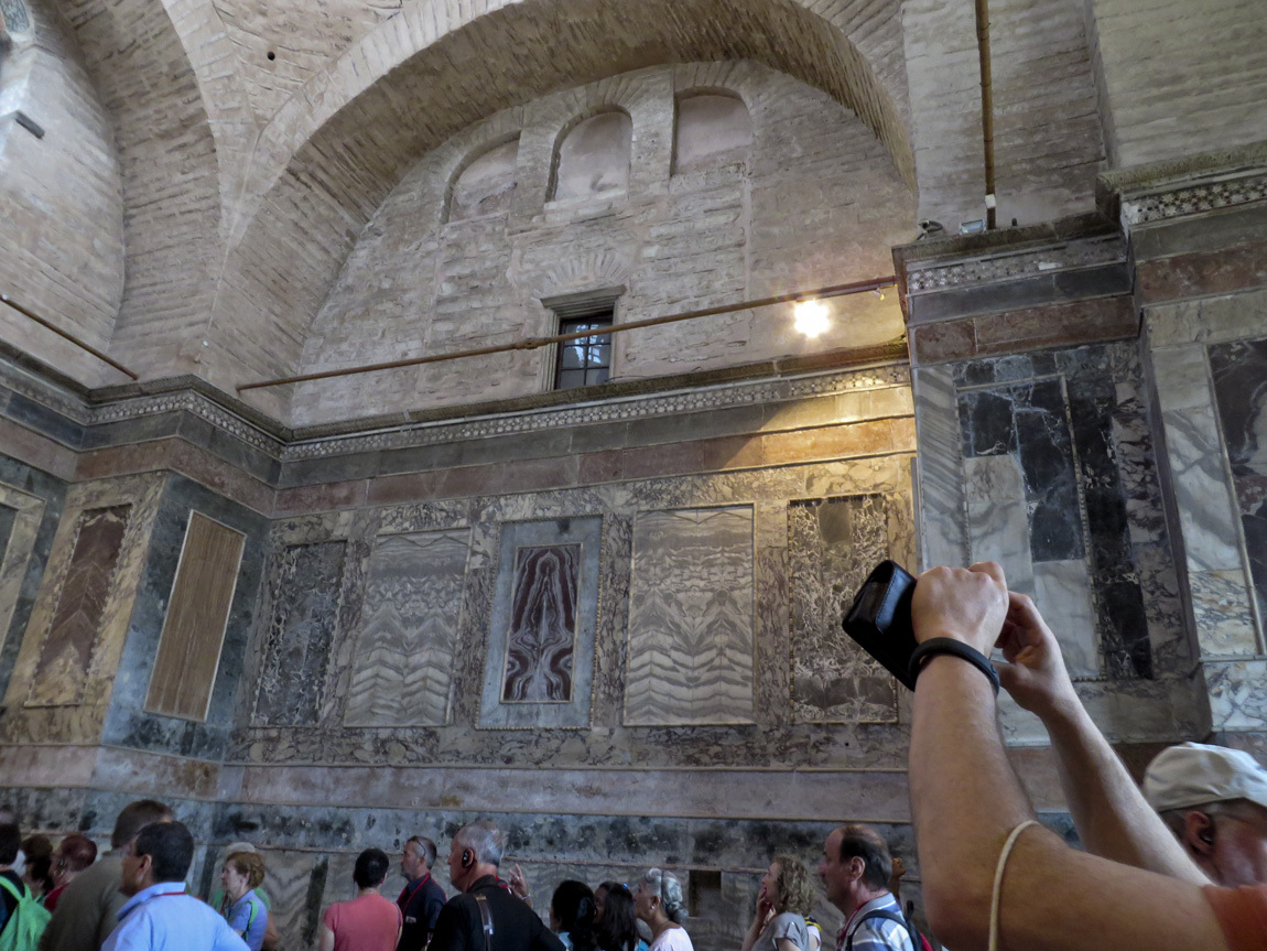
This part of the church shows how the church looked when it was a mosque. It also shows the crowds of tourists.
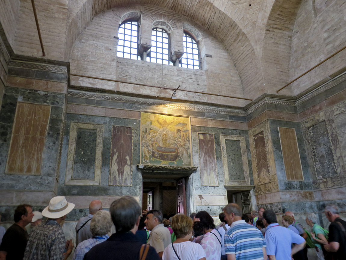
And in this photo some of the frescoes have been uncovered from their layer of plaster:
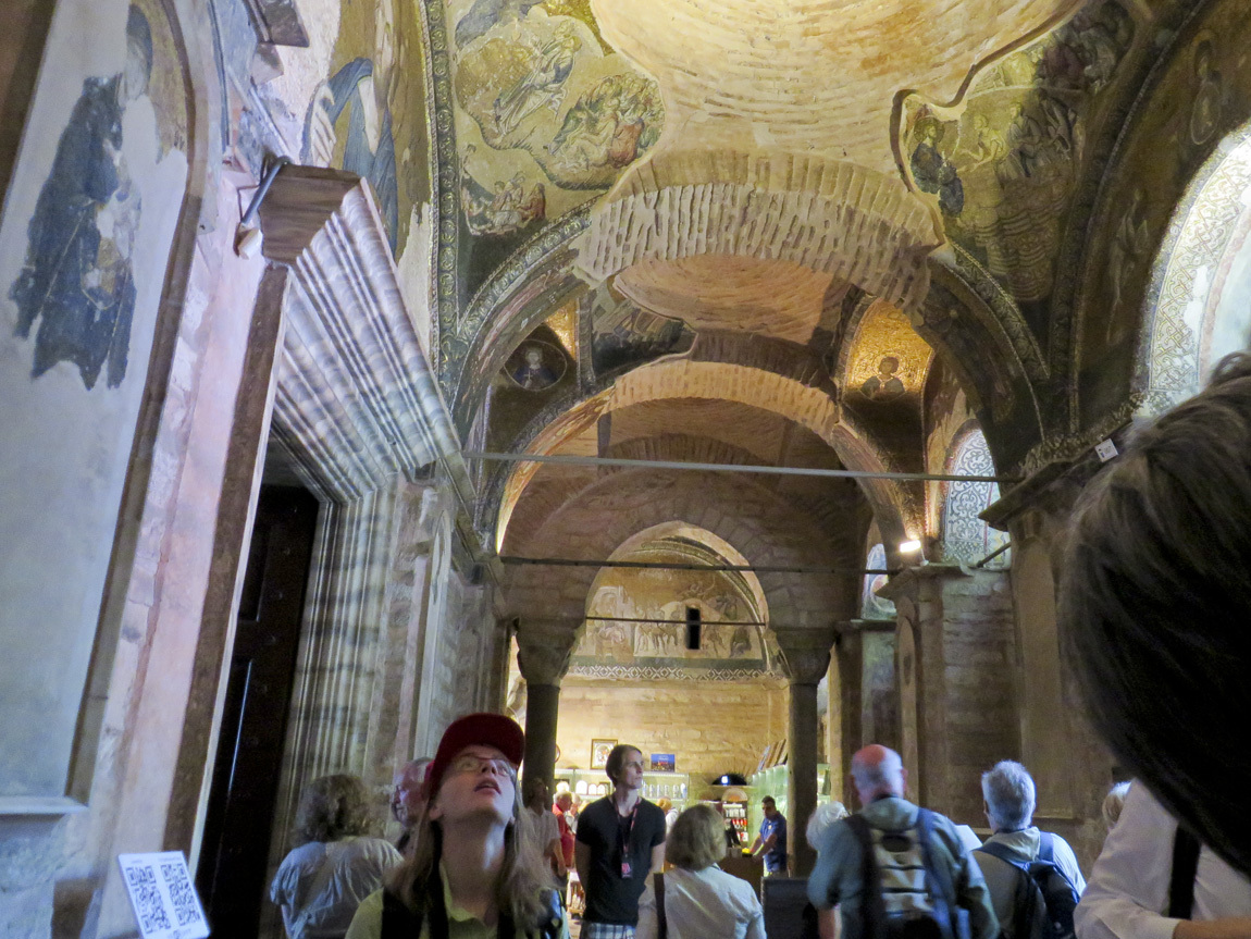
I like this photo because it shows a girl with her neck craned up to look at the frescoes on the ceiling.
A fresco, normal size and then with part of it enlarged to show the details of the tiles:
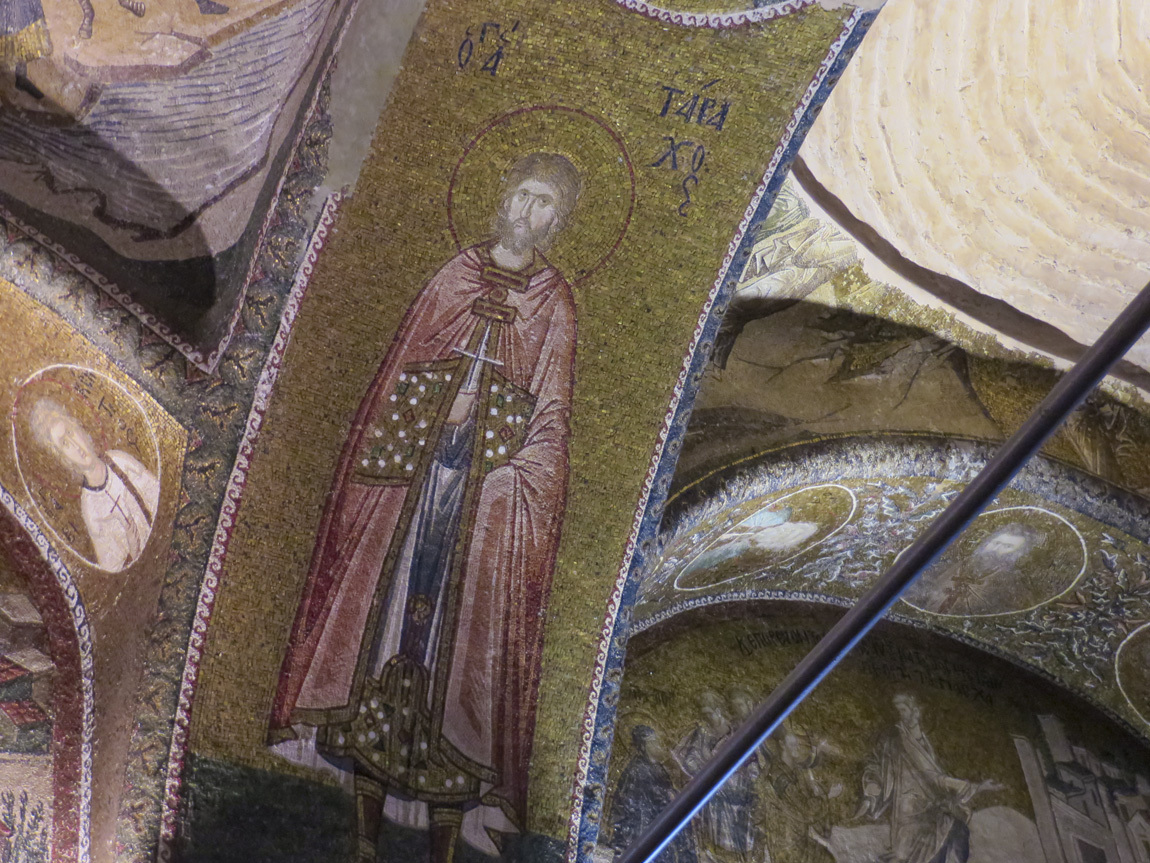
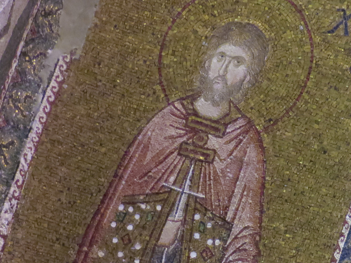
One last photo of the church.
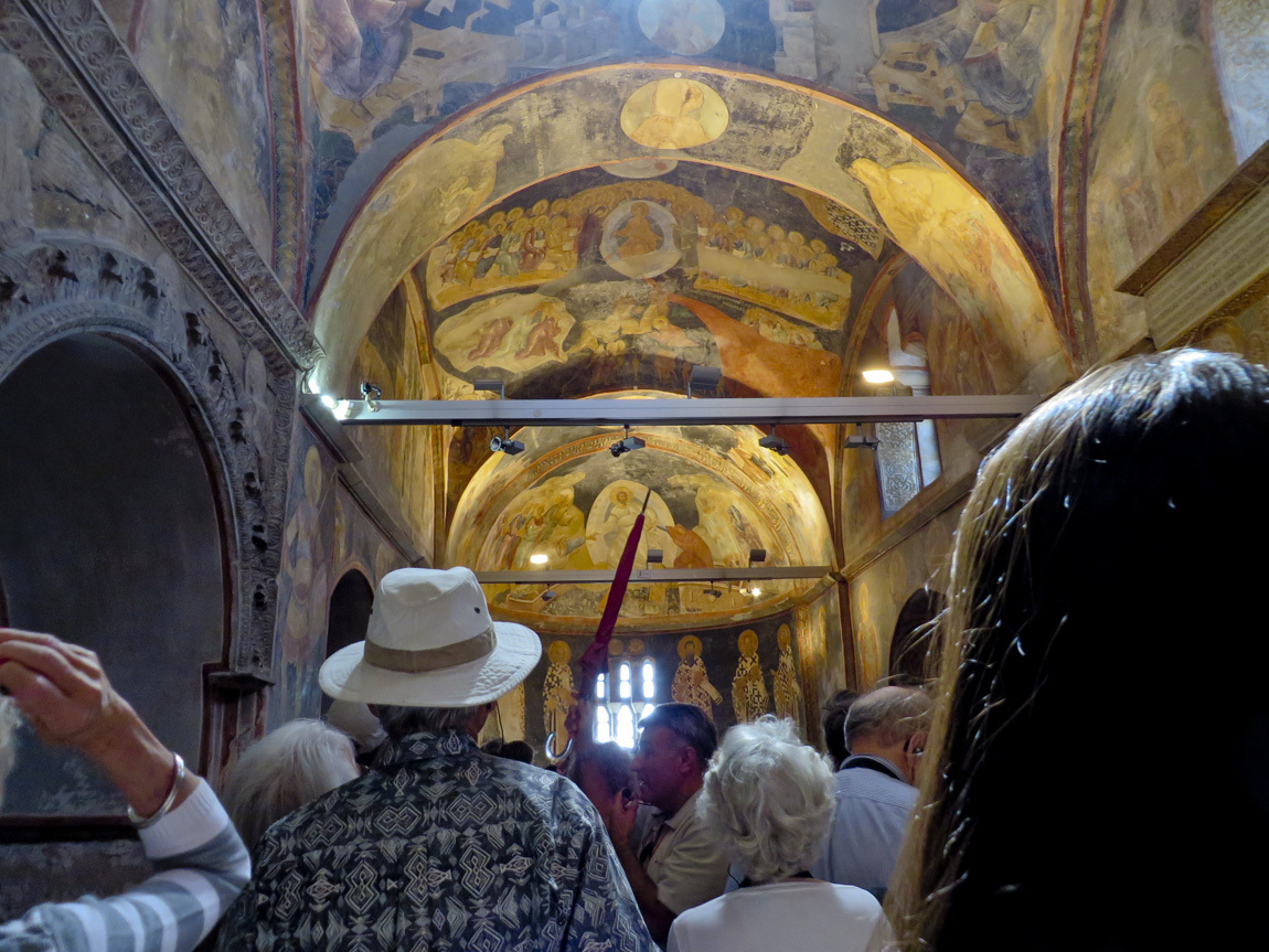
We have more stops this day, so it's back to the tour bus. That's another blog post.
Navigation:
First Turkey trip post.
Next Turkey post.
So 7 a.m. finds us downstairs looking for the breakfast room. Wow. What a display of food. Sliced fruits and fruit salad. Yogurt with many types of preserves, honeys, and granolas. Buffalo yogurt in jars. Smoked salmon, various sliced salamis, sliced cheeses. Cereal. Dried figs and other fruits. Sliced tomatoes and cucumbers. Olives. Tarts, croissant-like pastries, muffins, and loaves of bread ready to slice. Hot scrambled eggs that taste really good, along with potatoes and sausages. Borek, a traditional Turkish pastry of phyllo dough layered with eggs and cheese. I want to taste everything, I want this every day of my life!
After filling our plates we gather at white linen covered tables, and are offered coffee and orange juice. Conversation drifts back and forth between getting to know each other and the noises we heard from the Taksim Square protests last night. Then, ready for our first day's outing, we walk past the barricades to our awaiting bus. Our destination is Old Istanbul.
First a little geography. Below is a great map of Turkey from turkeytravelplanner.com. Turkey is all the green area on this map. Istanbul in the upper left corner (northwest). Note the waterways that connect the Black Sea to the Mediterranean Sea. First is the narrow Bosphorus, then the Sea of Marmara, then the narrow Dardanelles. Strategically speaking, control of the Bosphorus and Dardanelles means control of trade between the two seas. Also, over the ages people could easily cross the narrow waterways to navigate between Europe and Asia Minor. It's easy to see why a city grew at this location.

Old Istanbul is located on a peninsula formed by the Bosphorus, the Golden Horn, and the Sea of Marmara. The Golden Horn is an inlet of the Bosphorus, a natural harbor for the Greek, Roman, Byzantine, and Ottoman ships of yore. Today modern Istanbul spans both the Golden Horn and the Bosphorus.
Below is a map of Istanbul, courtesy of planetware.com. The Divan Hotel is on the western shore of the Bosphorus. I added three arrows: one marks our hotel, one marks a waterway called the Golden Horn, and one points to the area of Old Istanbul.

Old Istanbul was once a seaport named Byzantium, settled by Greek colonists. In 322 AD, Constantine the Great, a Roman emperor, decided to establish a new capital in Asia Minor. He chose Byzantium as the location. In 330, the city was renamed Constantinople, and it grew into a center of learning, prosperity, and culture, the center of the Byzantium Empire. It wasn't until 1453 that it was conquered and renamed Istanbul by the Ottoman Turks.
Today, Old Istanbul is rife with ruins of churches, mosques, palaces, and more. Tourist attractions, yes, but so interesting.
Our bus crosses the Golden Horn via the Ataturk Bridge. We see ruins of the walls that once surrounded the old city. I imagine how it must have felt living in the old walled city.
Our first destination is the Kariye Museum or, the Chora Byzantine Church. Our group follows Ali, carrying the umbrella. The umbrella helps us find him in the crowds. He gave us "whisperers", small radio receivers with headphones, so we can hear him talk about the sights. He can talk in a low voice, thus not disturbing the other tourists. Here we are, approaching the church:

Along our path is a multi-storied wooden building. I was intrigued by the pretty tiles that peaked out of a door of this decrepit building.


Nearer to Chora:

The Chora Byzantine Church was built in the 5th century, then extensively remodeled in the 12th century. It is one of the best surviving examples of a Byzantine church. The interior is covered with mosaics and frescos. The problem is that after Constantinople was conquered by the Turks in 1453, the Chora Church was converted into a mosque. Since Islam prohibits iconic images or any protrayal of human or animal forms, the mosaics and frescoes were covered with plaster. In 1948 it ceased to be a mosque and restoration of the original Byzantine interior began.
Here is another photo of the outside:

The tiles in the frescoes are smaller than I had expected. I took a few photos, but they are not really very good. It was difficult to get good photos because of the light and because it was very, very crowded! I'll just put a couple examples below, and advise any reader to check out the Wikipedia and museum links for professional photos.
(I didn't take my dSLR to Turkey, relying instead on a small, zoomable, pocketable, new Canon SX280 HS. Composing photos in the display instead of a viewfinder was often difficult, I'll apologize just this once for all of my photos on this trip. At home now, I am finding that I do appreciate the geotags on the photos. Win some, lose some.)
One of the frescoes inside:

A zoom in on the tiles:

This part of the church shows how the church looked when it was a mosque. It also shows the crowds of tourists.

And in this photo some of the frescoes have been uncovered from their layer of plaster:

I like this photo because it shows a girl with her neck craned up to look at the frescoes on the ceiling.

A fresco, normal size and then with part of it enlarged to show the details of the tiles:


One last photo of the church.

We have more stops this day, so it's back to the tour bus. That's another blog post.
Navigation:
First Turkey trip post.
Next Turkey post.
Comments
No comments yet
Add Comment