The Little Thompson.
This page has a lot of photos and takes awhile to load. But that's what it is about. If you want to see a larger version of any photo, click on it.
Ten years, each morning spent walking my dog (or dogs) down by the river. That river is the Little Thompson - a small stream, really - just an eighth of a mile from my home. In winter we walk along the road, but in early spring, when mornings are light and rattlesnakes sleeping, we walk next to the river. Up along the grassy river bank, under the trees, then across the fire sub-station parking lot, and back home along the road. Each first springtime river-walk, I follow Lucy, as the path is not visible to my eyes, only her senses; after a few days, the two of us make a clear footpath, winding through the weeds, trees, and rocks. Past tracks of animals, startled deer, squawking magpies. Perhaps not picturesque, but wild and “oursâ€.
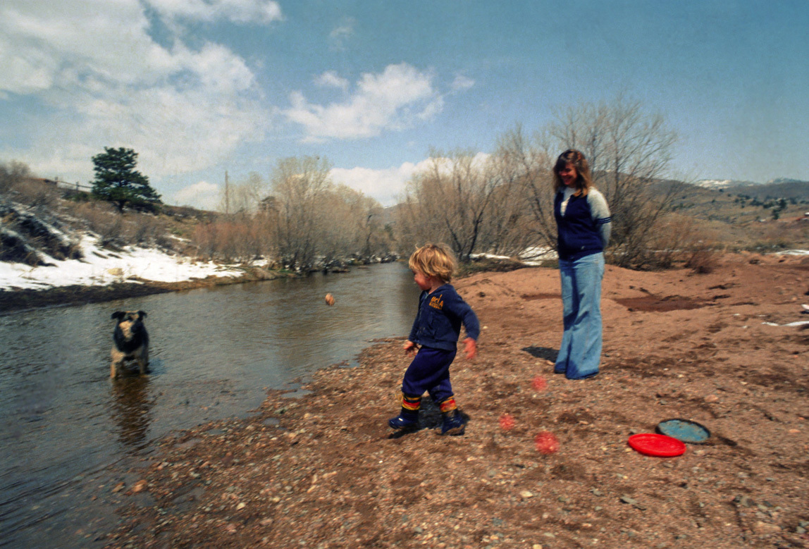
Back-up thirty years to when we moved here in 1981. There weren’t many homes back here in the X Bar Seven, and my cats used to follow me down to the river - there was that little car traffic. It was a great place to take a toddler and our frisbee-fetching water-loving dog named Rocky.
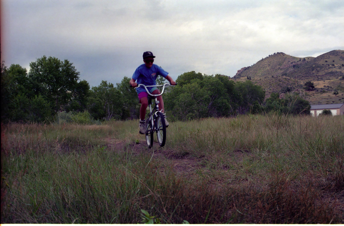
In the 1980s we were among a lot of young families in the X Bar Seven. My son jumped on his BMX to zoom to the river area; my daughter slung her ice skates over her shoulder and made a path through the snow to glide on the frozen pools. Summers it was swimsuits and rafts. There used to be a beaver dam down there. Sometimes neighbors would gather at the area under a big tree near the pools - before the fire station was built - and party. One day lightning hit the big tree. Scary, since a few people were pretty close. The blackened skeleton stood for years.
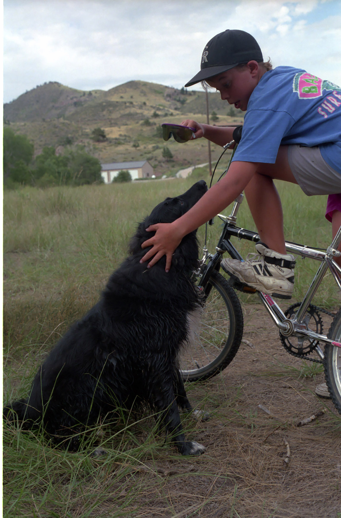
Here is Jamey and our dog Peppy down by the river.
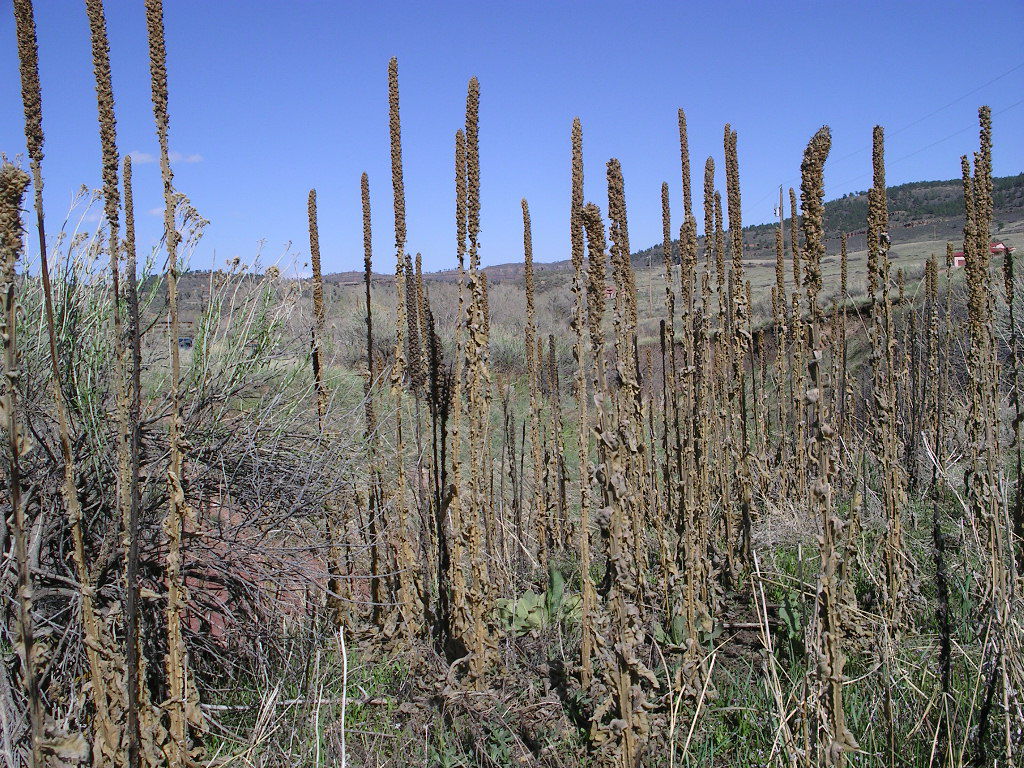
One spring in the 1990s the Little Thompson flooded and a lot of debris (including a canoe) caught in the old culvert-bridge system took out the road. They built a strong new bridge and a spillway past it. After the 1990s flood a new type of plant took over much of the area. I call them “squishy bushes†because they start as soft, pretty plants. They end up as dried up ugly stalks. (Their real name is common mullein.)
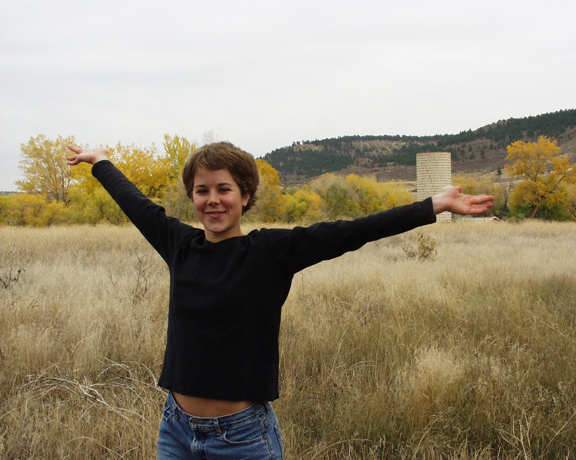
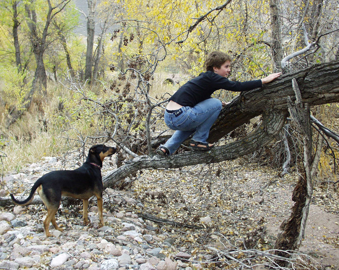
Tammy liked the area so much that we took her graduation photo there. Here she is by herself and with Lucy when Lucy was young.
In about 2000 I began my years of morning dog walks. Each morning I would stop, live in the moment, and realize how special it is out here.
Funny, I never thought to take photos specifically of the Little Thompson. It just was.
So . . . why am I waxing nostalgic? Why did I take all the photos below? Because of the Lyons floods in September 2013. The area has totally changed. One intent of his blog is to show my daughter who is living in Africa what our old playground now looks like.
Here goes. How it looks now.
Walking down the hill.
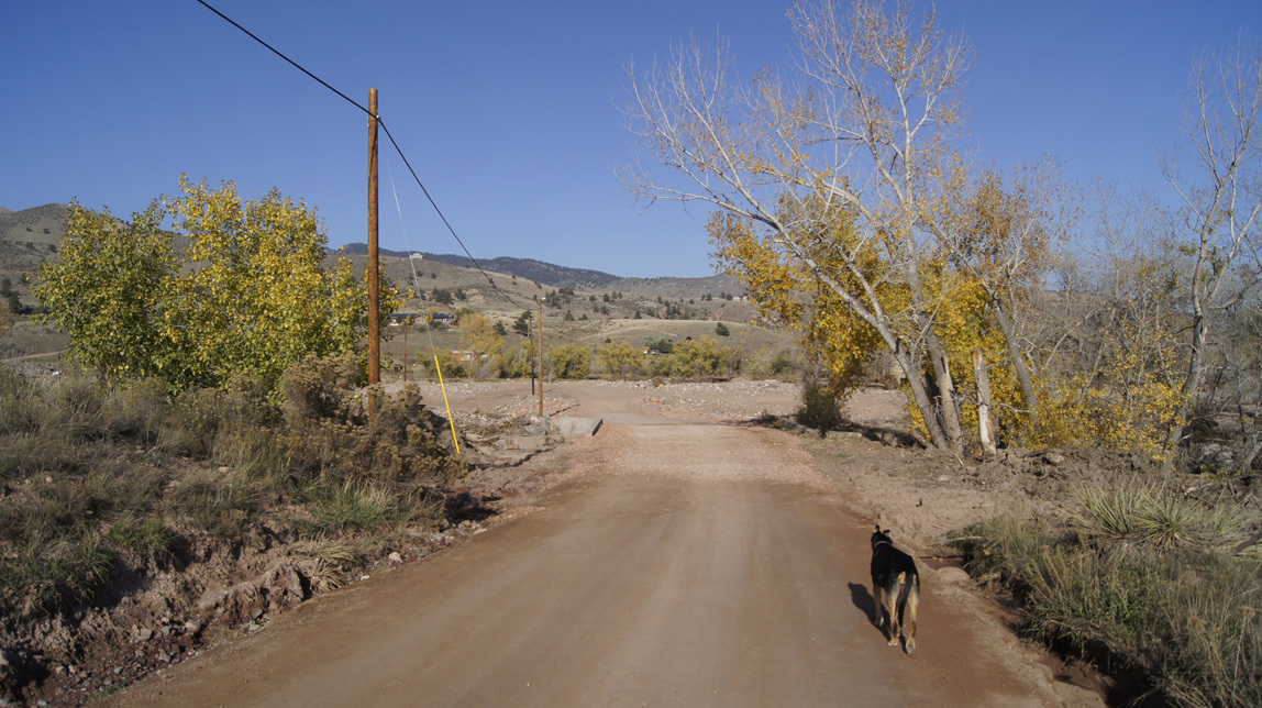
Below is the bridge built during the 1990s flood, intact, with the mostly-intact concrete spillway past it. Then past the spillway is the new roadway, made by piling quarry rocks above three long culverts. That was done while the river was still running like crazy on the Sunday after the flood.
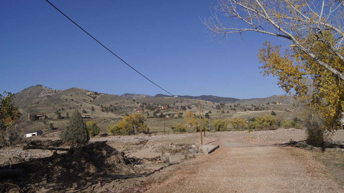
To the left of the bridge is the debris that they pulled from the bridge. During the flood, it was totally clogged and running both over the bridge and from there all the way to the fire station. The swiftest and most destructive water flowed just past the old spillway.
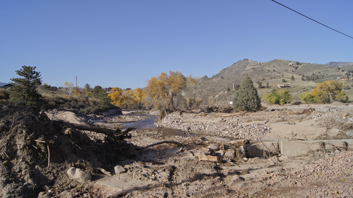
What you are seeing in the photo below is the repaired road (hopefully it will be fixed better later). When the river was still running fast, they pulled in the heavy equipment and scooped up rocks to re-channel the river. As the machines worked, Search and Rescue and National Guard forces stood at intervals along the rushing river, ready to act to rescue people if one of the machines fell over in the current. Then they dropped in long culverts and piled up slash sandstone rocks from the quarry. That was covered with smaller chunks.
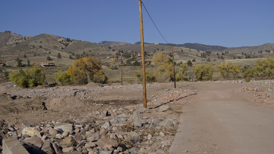
Drivers still have to go very slowly over those rocks. I can make it over with my mountain bike if I keep my wits about me. Lucy crosses them very slowly.
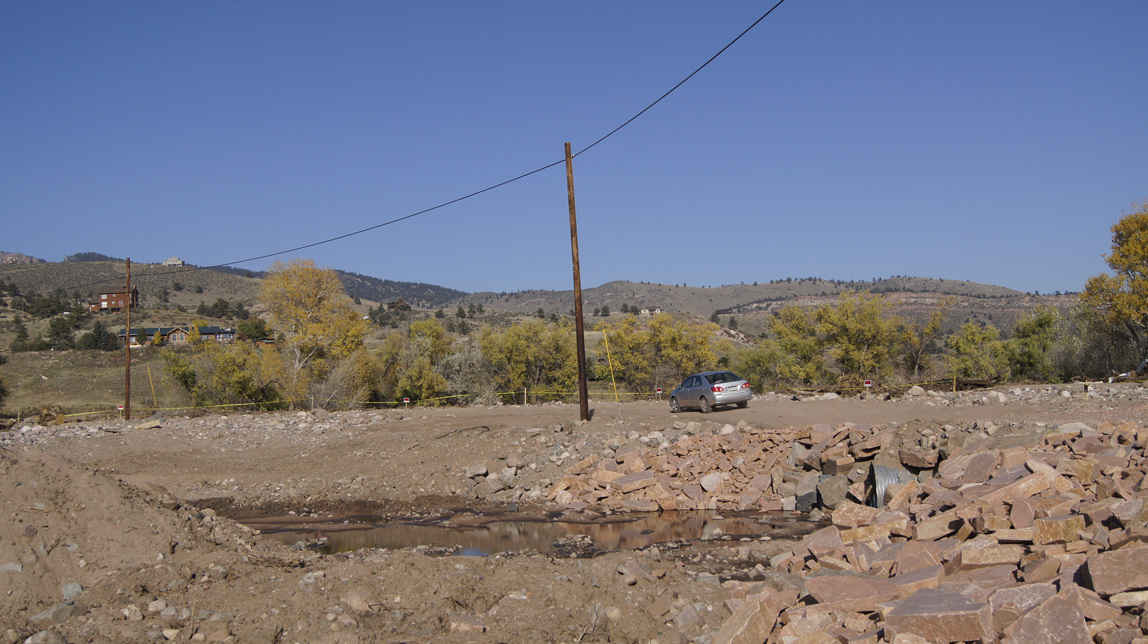
This old pine tree remains. I used to walk to the left of it; to the right was just a flat field filled with grasses and flowers and common mulleins. The big FEMA trucks went up this way and then over to the shallower area in front of the fire station to evacuate the stranded people that live the other side of the Little Thompson. Chinooks also landed in the field to evacuate people that wanted to leave. Most residents stayed and waited for the road to be fixed.
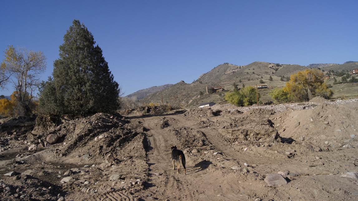
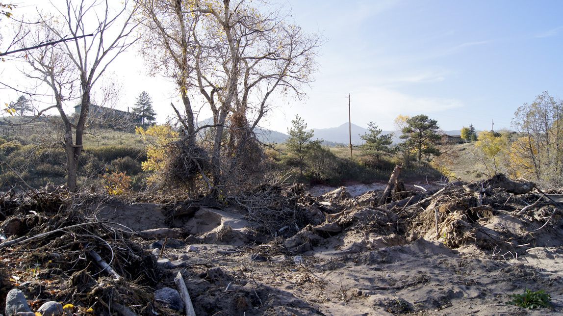
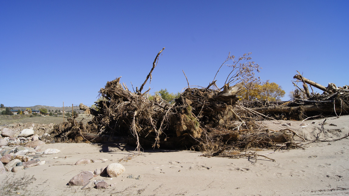
Big piles of debris.
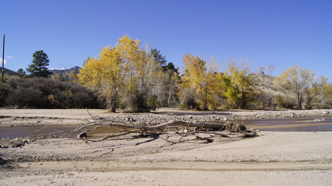
We now have sand-mesas.
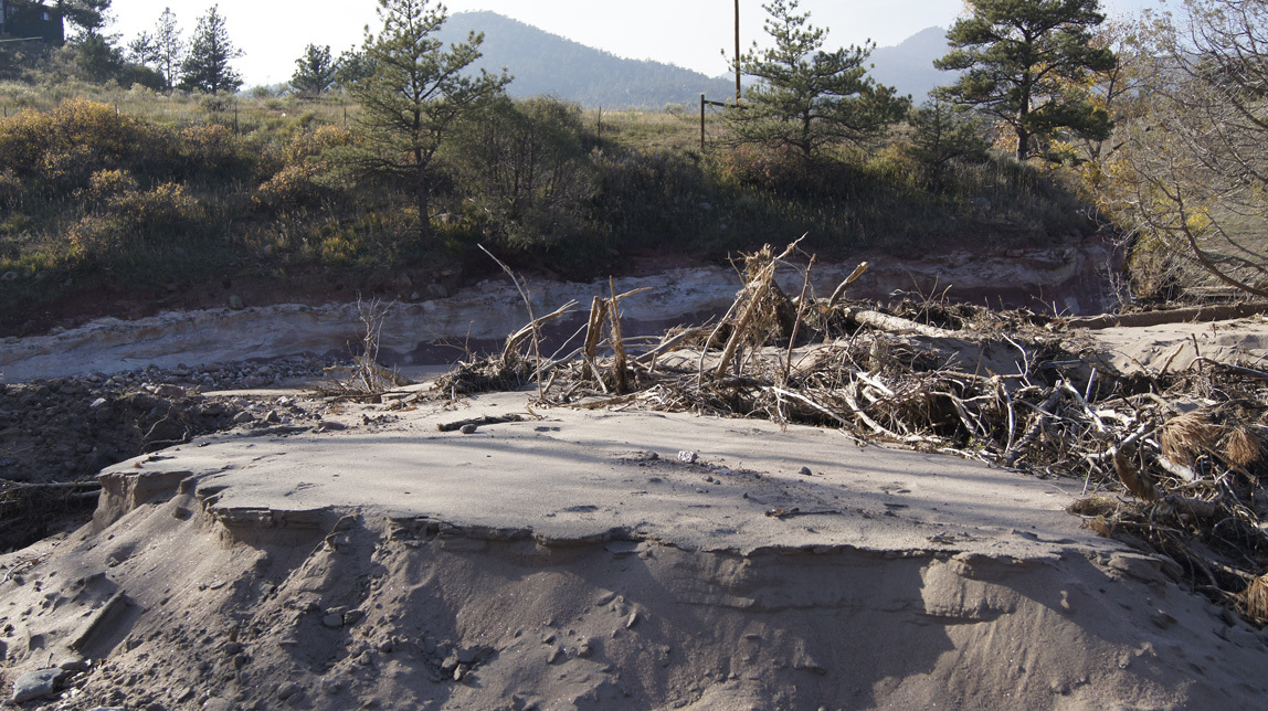
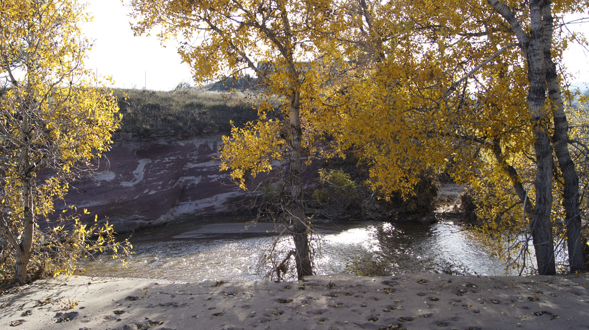
The old swimming hole and skating pond. A lot of it is now filled in with sand.
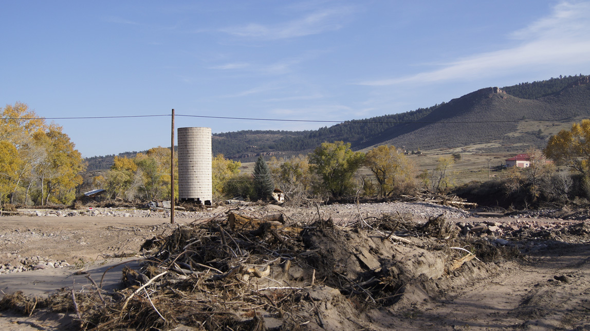
The old silo is missing most of the lower bricks. It will probably have to come down. In the distance is the remaining half of what we always call the “Brownings†house (the original X Bar Seven homestead). I have closer photos, but I am not going to share them. It is too private, and not my story to tell.
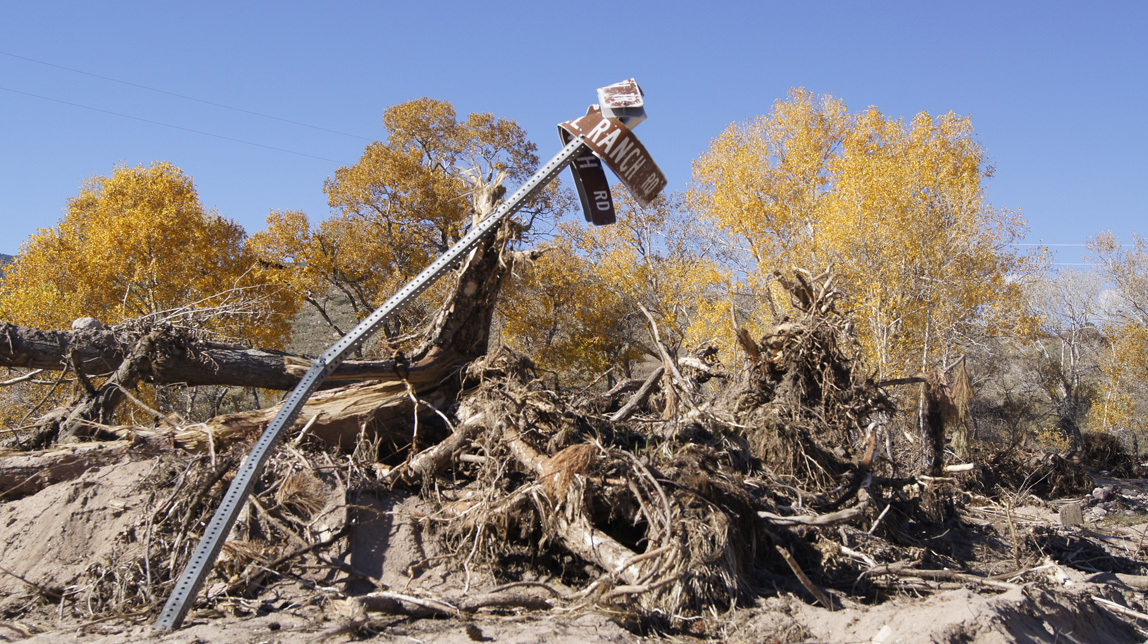
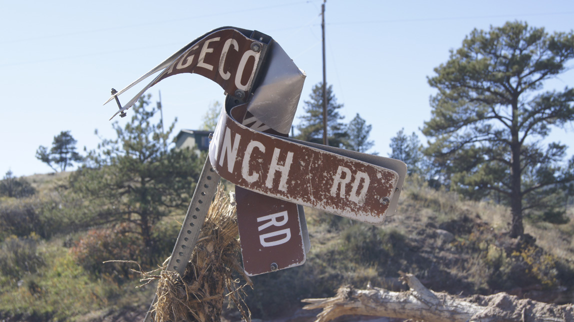
A street sign? Well yes, but it used to be several miles up the Little Thompson. It says “Stagecoach Trail†and “Pinwheel Ranch Roadâ€.
Continuing our walk, this is the view up towards the fire station. All of the river is now pretty much where it was pre-flood, but during the flood, one of the three swift channels ran along here.
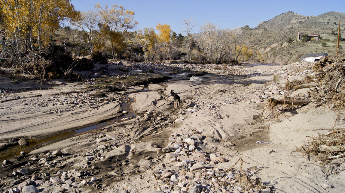
And here in the distance is the fire sub-station.
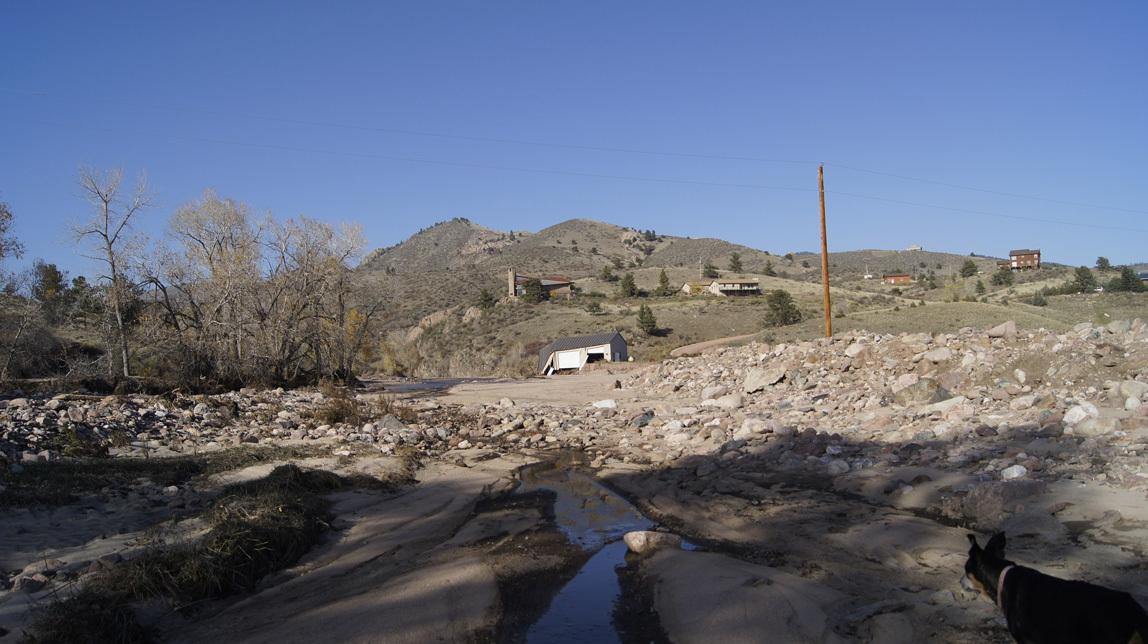
I turn around and take a photo of the way we came. Note the piles of river rocks. I was told that these rocks have been buried for about twenty thousand years. They are ancient rocks, seeing the light of day for the first time in ages. We have also heard that there might be gold in the rocks washed down from the Colorado Rockies.
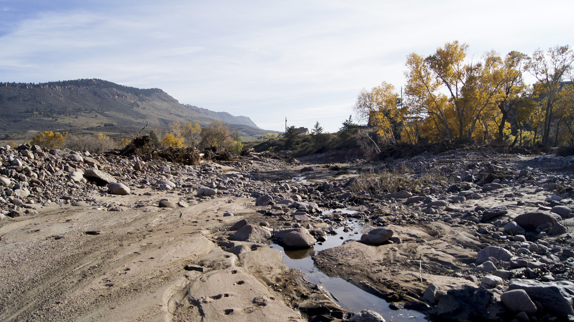
Fire station, closer. This big stretch of sandy area is soft on an old dog's feet.
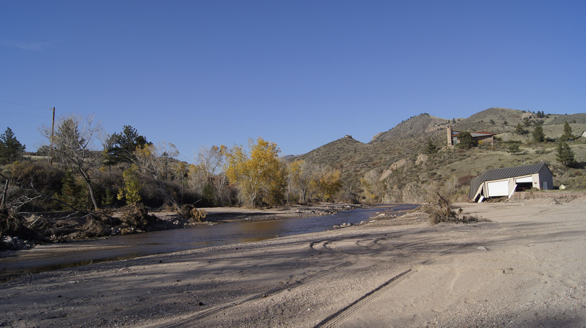
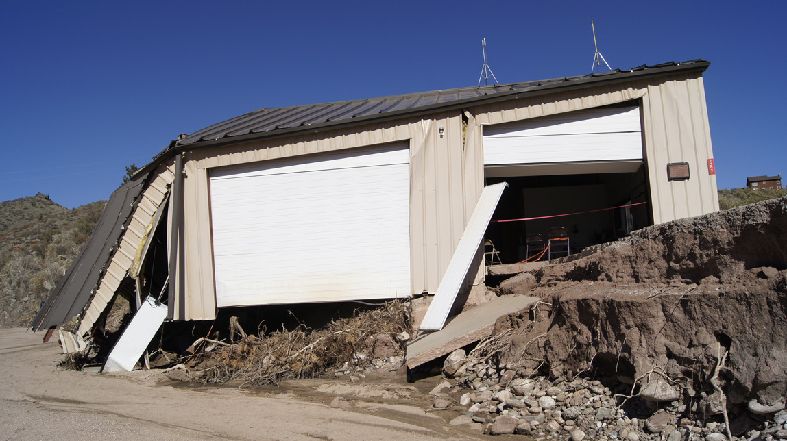
This shows clearly how deep the river was during the flood.
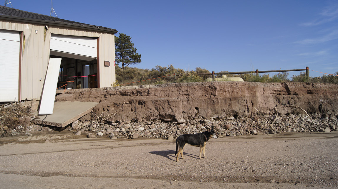
This is where the fire station parking area was. See the red barn/shed? Just beyond it is where the Chinook helicopters landed.
Looking up the Little Thompson from the fire station area.
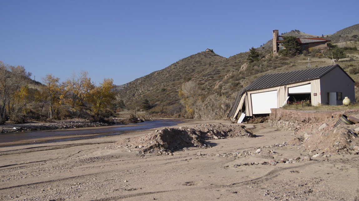
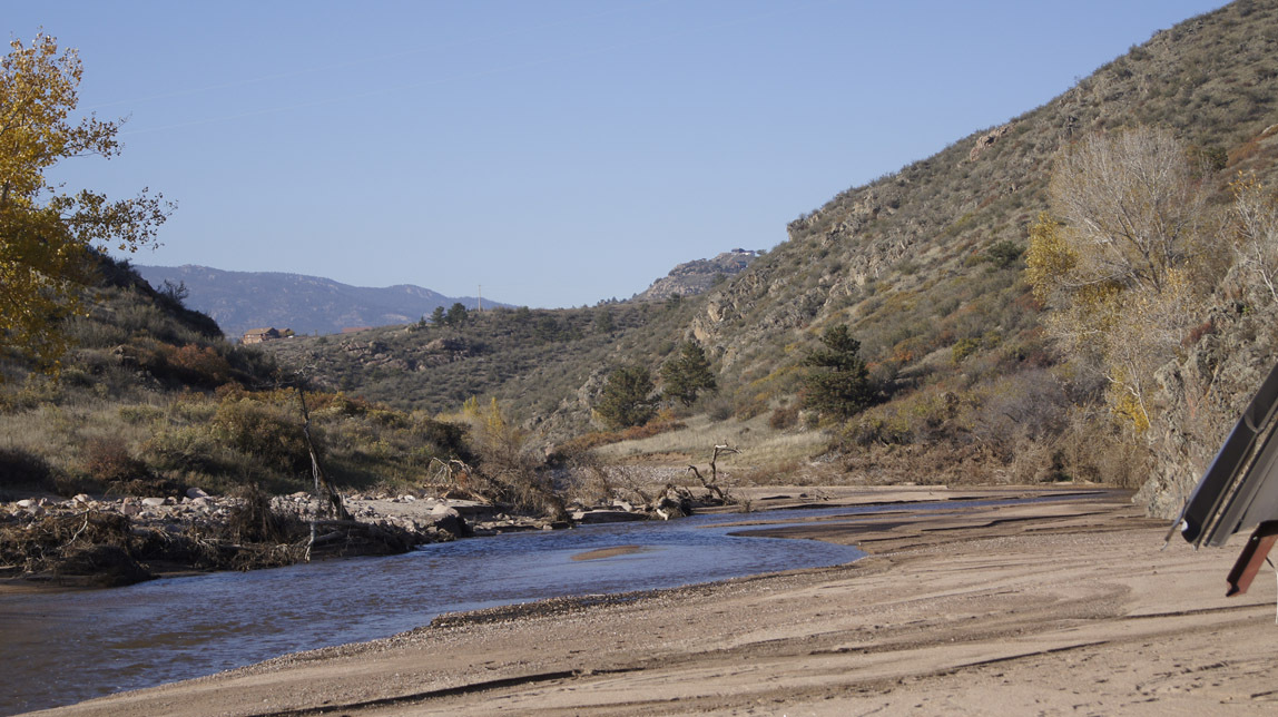
Looking back the way we came.
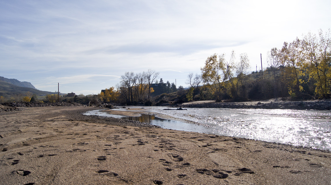
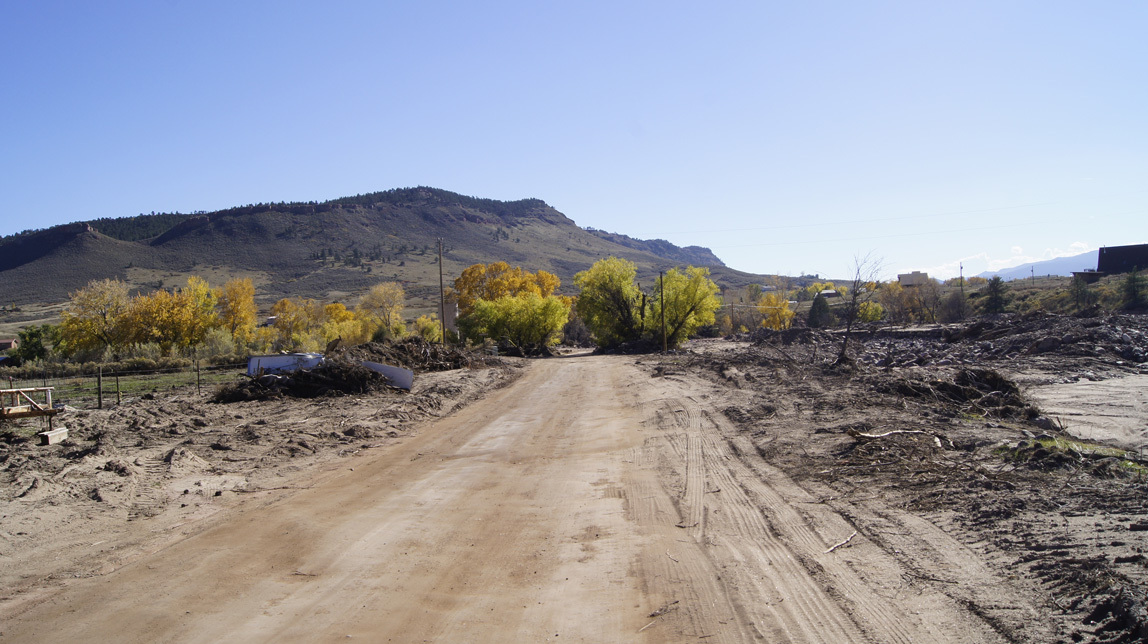
This is the view down the road coming back home from the fire station.
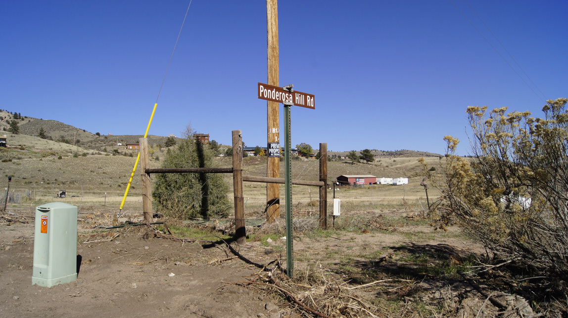
This is the sign for the junction of Ponderosa Hill Road and Stagecoach Trail. This was under water during the worst of the flood.
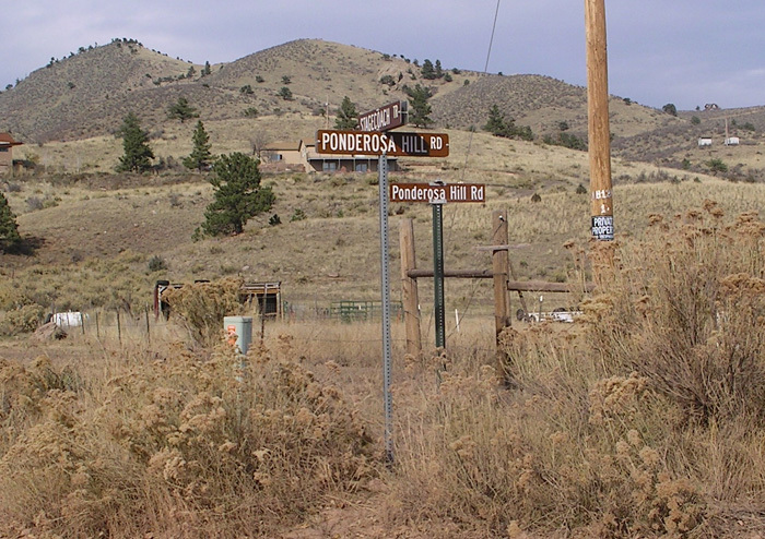
And it means that one of our road signs is now somewhere downriver, because this is what it looked like in 2007:
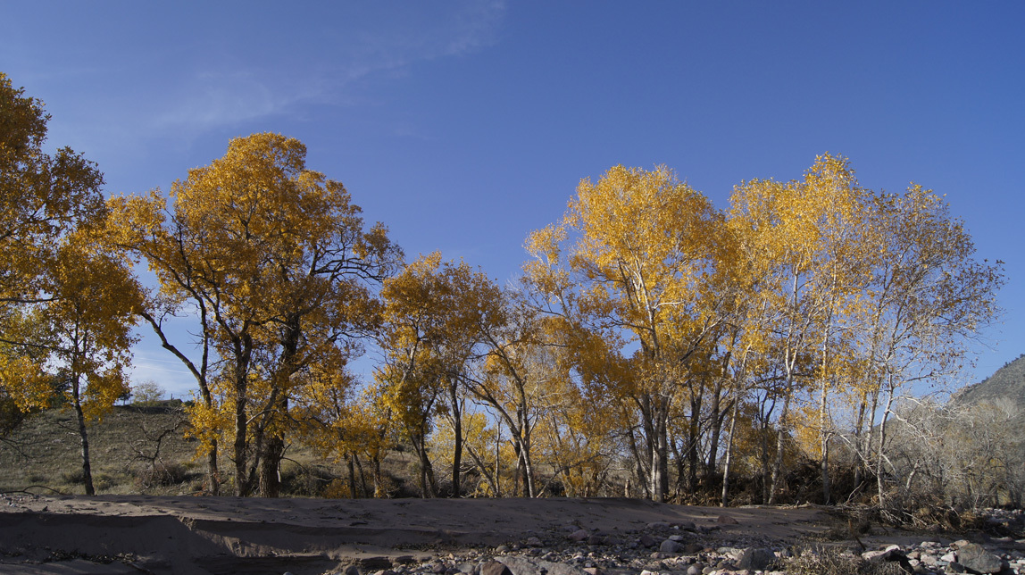
The fall trees still blaze against the sky.
The whole area still has beauty, it’s just different than it was before. Each morning I stop, live in the moment, and realize how amazing the world is.
First Lyons flood entry
Ten years, each morning spent walking my dog (or dogs) down by the river. That river is the Little Thompson - a small stream, really - just an eighth of a mile from my home. In winter we walk along the road, but in early spring, when mornings are light and rattlesnakes sleeping, we walk next to the river. Up along the grassy river bank, under the trees, then across the fire sub-station parking lot, and back home along the road. Each first springtime river-walk, I follow Lucy, as the path is not visible to my eyes, only her senses; after a few days, the two of us make a clear footpath, winding through the weeds, trees, and rocks. Past tracks of animals, startled deer, squawking magpies. Perhaps not picturesque, but wild and “oursâ€.
Back-up thirty years to when we moved here in 1981. There weren’t many homes back here in the X Bar Seven, and my cats used to follow me down to the river - there was that little car traffic. It was a great place to take a toddler and our frisbee-fetching water-loving dog named Rocky.

In the 1980s we were among a lot of young families in the X Bar Seven. My son jumped on his BMX to zoom to the river area; my daughter slung her ice skates over her shoulder and made a path through the snow to glide on the frozen pools. Summers it was swimsuits and rafts. There used to be a beaver dam down there. Sometimes neighbors would gather at the area under a big tree near the pools - before the fire station was built - and party. One day lightning hit the big tree. Scary, since a few people were pretty close. The blackened skeleton stood for years.
Here is Jamey and our dog Peppy down by the river.


One spring in the 1990s the Little Thompson flooded and a lot of debris (including a canoe) caught in the old culvert-bridge system took out the road. They built a strong new bridge and a spillway past it. After the 1990s flood a new type of plant took over much of the area. I call them “squishy bushes†because they start as soft, pretty plants. They end up as dried up ugly stalks. (Their real name is common mullein.)

Tammy liked the area so much that we took her graduation photo there. Here she is by herself and with Lucy when Lucy was young.


In about 2000 I began my years of morning dog walks. Each morning I would stop, live in the moment, and realize how special it is out here.
Funny, I never thought to take photos specifically of the Little Thompson. It just was.
So . . . why am I waxing nostalgic? Why did I take all the photos below? Because of the Lyons floods in September 2013. The area has totally changed. One intent of his blog is to show my daughter who is living in Africa what our old playground now looks like.
Here goes. How it looks now.
Walking down the hill.

Below is the bridge built during the 1990s flood, intact, with the mostly-intact concrete spillway past it. Then past the spillway is the new roadway, made by piling quarry rocks above three long culverts. That was done while the river was still running like crazy on the Sunday after the flood.

To the left of the bridge is the debris that they pulled from the bridge. During the flood, it was totally clogged and running both over the bridge and from there all the way to the fire station. The swiftest and most destructive water flowed just past the old spillway.

What you are seeing in the photo below is the repaired road (hopefully it will be fixed better later). When the river was still running fast, they pulled in the heavy equipment and scooped up rocks to re-channel the river. As the machines worked, Search and Rescue and National Guard forces stood at intervals along the rushing river, ready to act to rescue people if one of the machines fell over in the current. Then they dropped in long culverts and piled up slash sandstone rocks from the quarry. That was covered with smaller chunks.

Drivers still have to go very slowly over those rocks. I can make it over with my mountain bike if I keep my wits about me. Lucy crosses them very slowly.

This old pine tree remains. I used to walk to the left of it; to the right was just a flat field filled with grasses and flowers and common mulleins. The big FEMA trucks went up this way and then over to the shallower area in front of the fire station to evacuate the stranded people that live the other side of the Little Thompson. Chinooks also landed in the field to evacuate people that wanted to leave. Most residents stayed and waited for the road to be fixed.

Big piles of debris.


We now have sand-mesas.

The old swimming hole and skating pond. A lot of it is now filled in with sand.

The old silo is missing most of the lower bricks. It will probably have to come down. In the distance is the remaining half of what we always call the “Brownings†house (the original X Bar Seven homestead). I have closer photos, but I am not going to share them. It is too private, and not my story to tell.

A street sign? Well yes, but it used to be several miles up the Little Thompson. It says “Stagecoach Trail†and “Pinwheel Ranch Roadâ€.


Continuing our walk, this is the view up towards the fire station. All of the river is now pretty much where it was pre-flood, but during the flood, one of the three swift channels ran along here.

And here in the distance is the fire sub-station.

I turn around and take a photo of the way we came. Note the piles of river rocks. I was told that these rocks have been buried for about twenty thousand years. They are ancient rocks, seeing the light of day for the first time in ages. We have also heard that there might be gold in the rocks washed down from the Colorado Rockies.

Fire station, closer. This big stretch of sandy area is soft on an old dog's feet.


This shows clearly how deep the river was during the flood.

This is where the fire station parking area was. See the red barn/shed? Just beyond it is where the Chinook helicopters landed.
Looking up the Little Thompson from the fire station area.


Looking back the way we came.

This is the view down the road coming back home from the fire station.

This is the sign for the junction of Ponderosa Hill Road and Stagecoach Trail. This was under water during the worst of the flood.

And it means that one of our road signs is now somewhere downriver, because this is what it looked like in 2007:

The fall trees still blaze against the sky.

The whole area still has beauty, it’s just different than it was before. Each morning I stop, live in the moment, and realize how amazing the world is.
First Lyons flood entry
Comments
No comments yet
Add Comment